A Field Guide to WRC Rivers
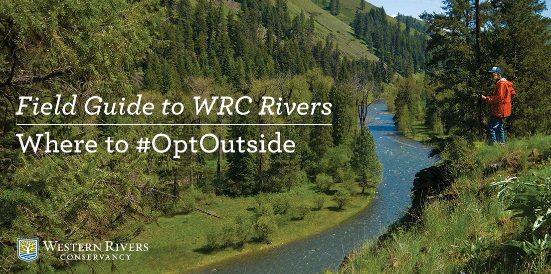
Western Rivers Conservancy is heading to the river this Black Friday when we #OptOutside with REI and millions of others who've decided to skip the madness of the mall and hit the great outdoors. Our destination of choice, of course, is the sweet smelling, soul soothing river, where we'll hike, fish, birdwatch and maybe even do a little winter kayaking. We hope you'll do the same!
To help you decide where to go, here's an abbreviated Field Guide to WRC Rivers--places where we have acquired land to protect habitat and create and improve public river access for all! And if you like these rivers, support our efforts to do more on great rivers around the West.
See you on the river!
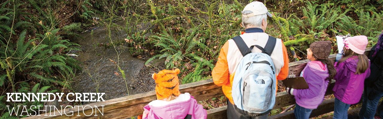
Location: 20 minutes northwest of Olympia; 2 hours southwest of Seattle; 2.5 hours north of Portland
The River: Only 12 miles northwest of Olympia, Kennedy Creek is one of the most productive chum salmon streams in all of Washington State, with average fall runs topping 30,000 fish. Some 2,500 local schoolchildren, along with their chaperones, visit the creek every November to view this incredible migration and learn the importance of rivers and salmon. We're in the midst of the salmon run, so now is the time to visit!
The Story: WRC is working to conserve almost all of the unprotected lands along Kennedy Creek, from its headwaters in Capitol State Forest to the Kennedy Creek Natural Area Preserve at the Puget Sound’s Totten Inlet. These lands include the majority of the chum salmon spawning grounds within the stream.
Where to go: A short walk from the Hwy 101 will lead you to the Kennedy Creek Salmon Trail, a free interpretive trail that is open on the weekends throughout October and November — prime salmon viewing time.
Kennedy Creek Salmon Trail directions | More about WRC’s effort on Kennedy Creek
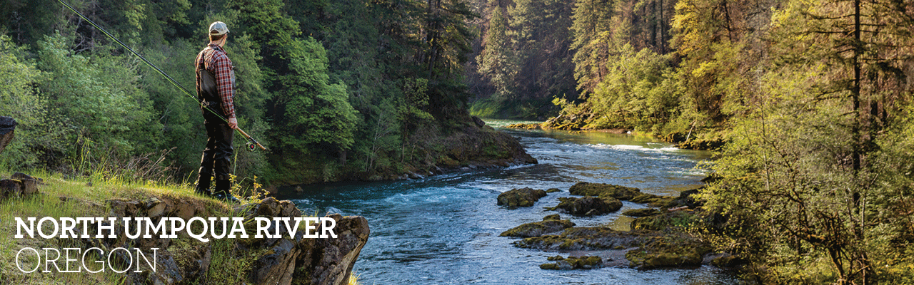
Location: 3.5 hours south of Portland; 2 hours north of Medford
The River: With its clean, cold water and majestic old growth forests, the North Umpqua River is one of the West’s great strongholds for salmon, steelhead and Pacific Northwest wildlife. Flanked by the 79-mile North Umpqua Trail (aka, “the NUT,”) it’s also an outdoor paradise for anglers, hikers, mountain bikers, campers and birders.
The Story: WRC is working to preserve the former Swiftwater County Park and its old growth forest, prime salmon habitat and a crucial trailhead at the very head of the North Umpqua Trail and the river’s fly-fishing-only water.
Where to go: Hit the North Umpqua Trail starting at Swiftwater Park, where you can hike or bike for nearly 80 miles up the river. The trailhead parking area south of the Swiftwater Bridge has interpretive panels, a small picnic area and a restroom.
North Umpqua directions | More about WRC’s effort on the North Umpqua
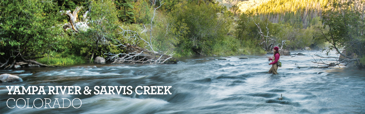
Location: 30 minutes south of Steamboat Springs; 3 hours northwest of Denver
The River: Free-flowing for much of its length, the Yampa is one of Colorado’s great rivers, flowing from the Flat Tops Wilderness to the Green River in Dinosaur National Monument. The upper Yampa, particularly the reaches below Stagecoach Reservoir, is known for its trophy trout fishing and nearby hiking and hunting.
The Story: WRC conserved the historic Hubbard’s Summer Camp, which spans a half-mile of the Yampa River at the confluence of Sarvis Creek, three miles downstream from Stagecoach Reservoir. WRC conveyed the lands to the BLM and U.S. Forest Service, which now manage them for their outstanding conservation and recreation values.
Where to go: As any local knows, this stretch of the Yampa supports trophy rainbow and brown trout, making it a must for anglers. Hiking more your thing? The adjacent 44,500-acre Sarvis Creek Wilderness Area has 20-plus miles of trails.
Hubbard’s Summer Place directions | More about WRC’s effort on the Yampa and Sarvis Creek
Location: One hour northeast of Chico; 2.5 hours southeast of Redding; 3 hours north of Sacramento
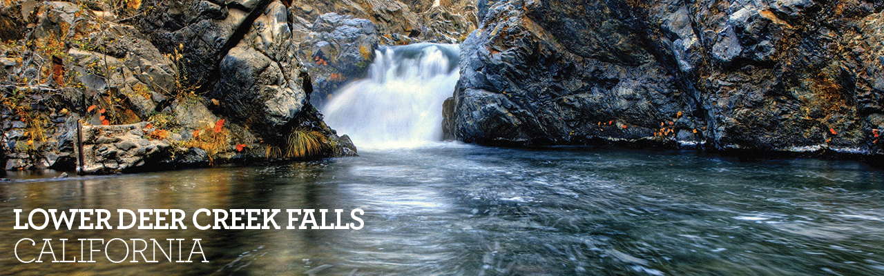
The River: Flowing cold and clean from the Sierra Nevada foothills to the Sacramento River, Deer Creek is rarity: a pristine California stream that has strong runs of steelhead and spring Chinook. The upper reaches flow through old growth forests that are prime habitat for California spotted owl, black bear and other wildlife, while the lower reaches tumble through scenic volcanic canyons.
The Story: Working with the Northern California Regional Land Trust, WRC conserved 600 acres centered around Lower Deer Creek Falls—a stunning cascade that plunges through a scenic rock gorge. By preserving this property, WRC was able to create a link between the Lassen National Forest and the Ishi Wilderness downstream, creating a fully protected fish and wildlife habitat corridor along Deer Creek.
Where to go: To experience the rugged beauty of the Sierra Nevada, all it takes is a detour off Highway 32 to the Deer Creek Trail, a 4.6-mile in-and-out trail that winds through the creek’s scenic canyon and brings you right to Lower Deer Creek Falls. The trail is below the snowline, making it accessible nearly year-round.
Deer Creek Trail directions | More about WRC’s effort on Deer Creek
Location: 2.25 hours east of Portland; 30 minutes north of Condon
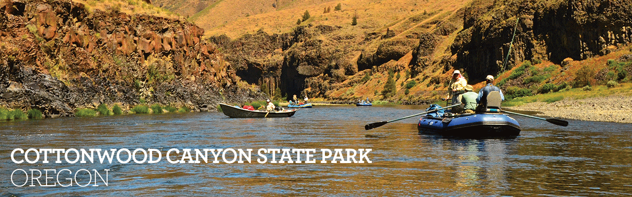
The River: Oregon’s John Day River is the second longest free-flowing river west of the Continental Divide. It flows through spectacular canyons, past surreal rock formations and through remote Wilderness Study Areas, offering some of the best multi-day river floats in the West. The best place to hike, birdwatch and otherwise explore by foot or mountain bike is Cottonwood Canyon State Park, between Wasco and Condon.
The Story: In 2013, WRC created Cottonwood Canyon State Park to conserve 16 miles of the lower John Day River and 16,000 acres of rare shrub-steppe habitat. We also created new public access along a reach of the river that was almost entirely private. Our partner was Oregon Parks and Recreation Department, which now manages the lands for fish, wildlife and people.
Where to go: Start at the state park visitors center, where you can pick up a map of the park showing trails along and above the river. There is a first-come, first-served campground, picnic grounds and restrooms. Mountain biking is allowed on some designated trails.
Cottonwood Canyon State Park directions | More about WRC’s effort on the John Day
